
US commercial drone company DroneDeploy has launched new tools for site inspection and 3D measurement, including the Walkthrough app, and a beta preview of its new Ground Robotics offering.
DroneDeploy 360 Walkthrough was launched in 2020, to capture 360 degree walkthrough images and document projects. The company has now launched this as a companion app for iOS. Engineers can capture conditions for client updates, documentation, and planning, while assets can be digitally documented for faster, more efficient, remote inspections. DroneDeploy has also added Floor Plan View to 360 Walkthrough, an interior view which allows data to be directly overlaid on floorplans.
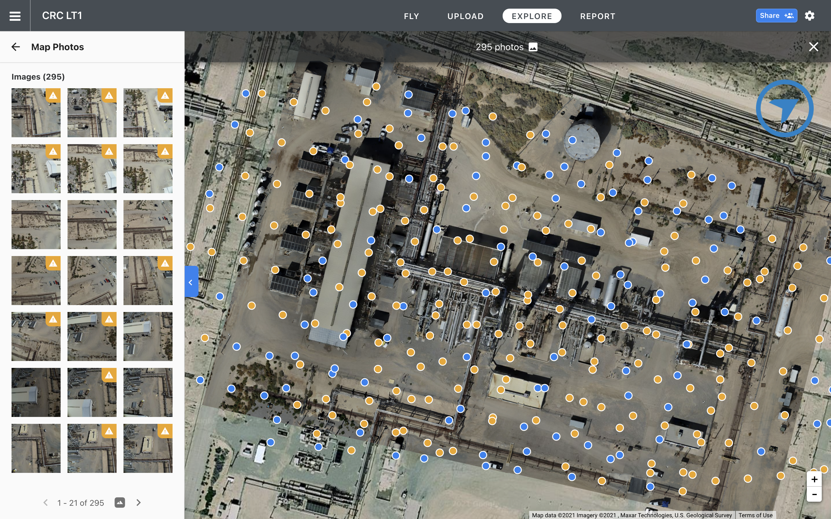
Photo Inspection allows an engineer or field worker to upload photos without processing into a map. Inspections can be carried out immediately on an asset, on photos captured from drones in the air or from cameras or mobile devices on the ground. Photos are tagged with the project location and team members on site can be quickly alerted to problems,
For its Enterprise customers, DroneDeploy has announced the beta launch of its Ground Robotics solution. Instead of aerial drones, ground robots such as rovers or quadrupeds like Spot from Boston Dynamics are equipped with payloads such as 360˚ cameras, thermal cameras, or gas sensors, to capture data and send it back to the DroneDeploy platform for analysis. These autonomous inspections can replace a physical walkthrough by an employee, with data uploaded to DroneDeploy and connected to the 360 Walkthrough platform. Any issues, such as loose wiring or debris, can be tagged and annotated and assigned to employees.